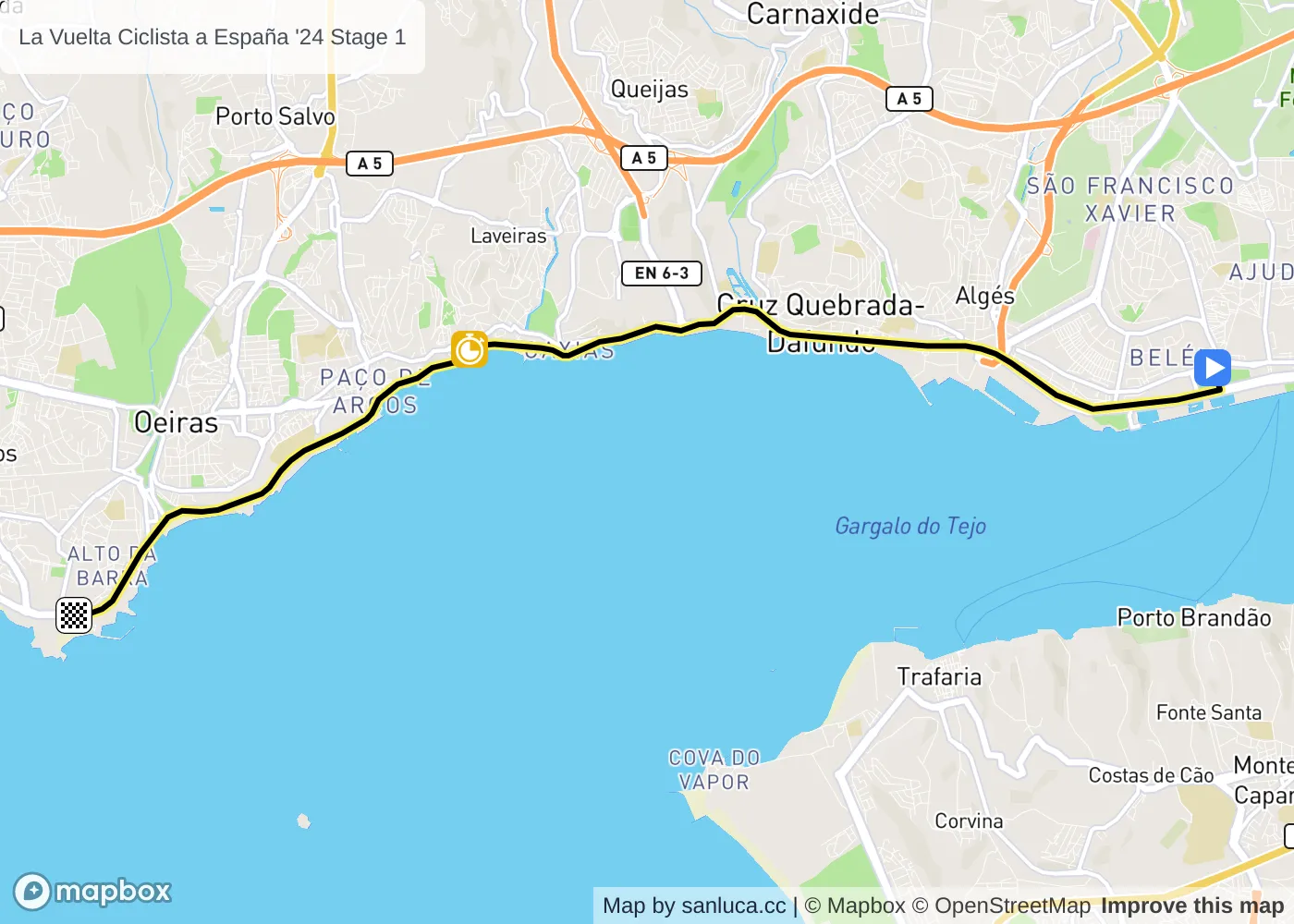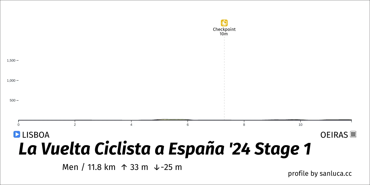
- Total distance: 11.8 km
- Type: Flat
- Ascent: 33.1 m
- Descent: -25 m
- Date: Aug 17
- Start time: 15:23
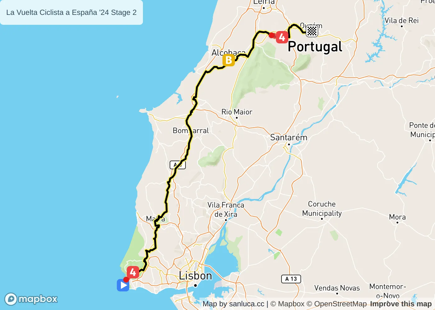
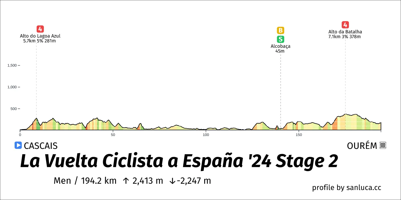
- Total distance: 194.2 km
- Type: Hilly
- Ascent: 2412.5 m
- Descent: -2246.8 m
- Date: Aug 18
- Start time: 11:06
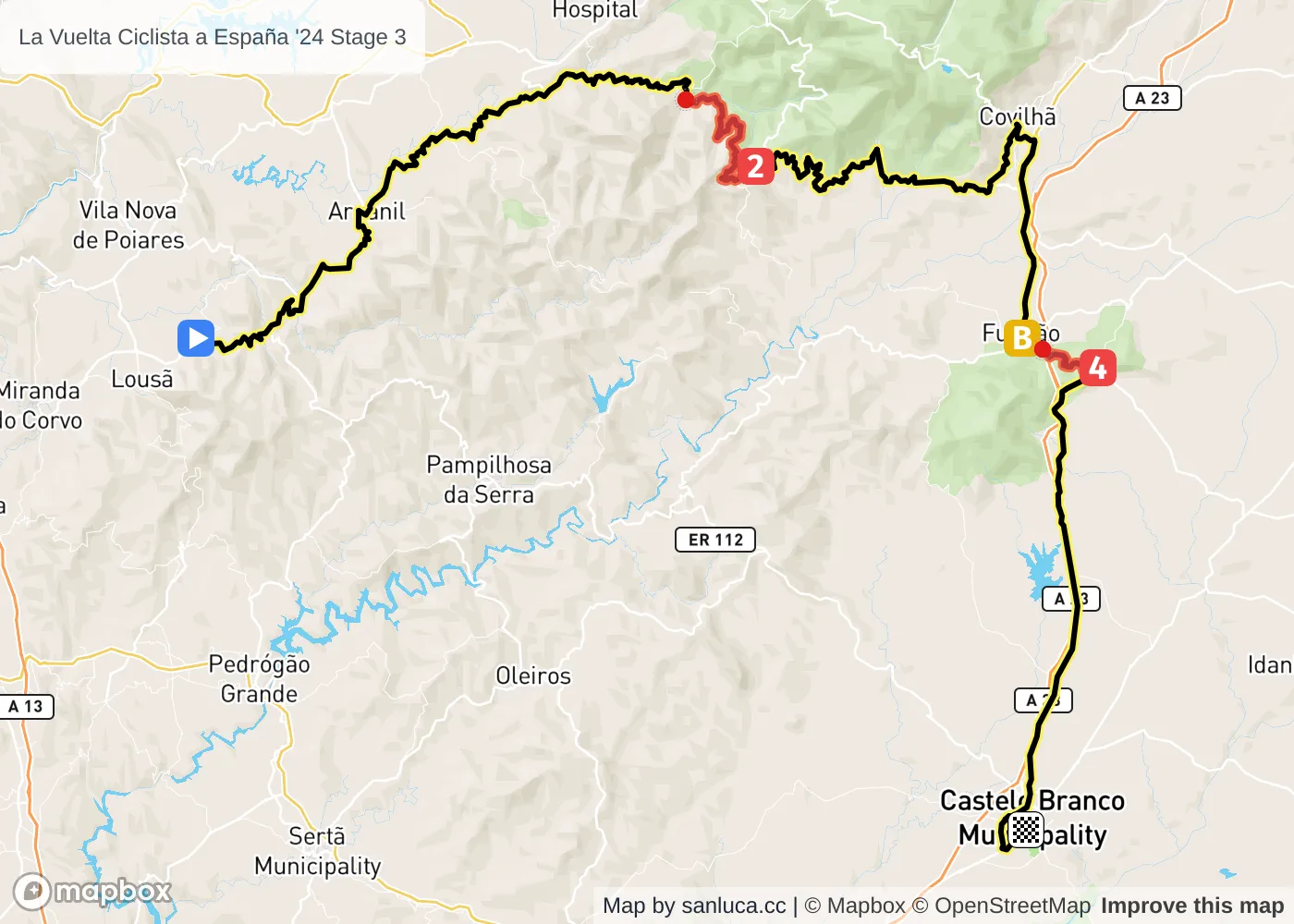
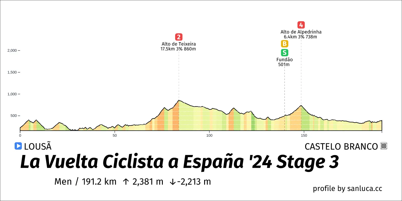
- Total distance: 191.2 km
- Type: Hilly
- Ascent: 2380.9 m
- Descent: -2212.8 m
- Date: Aug 19
- Start time: 11:04
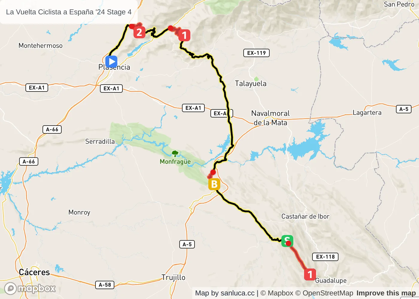
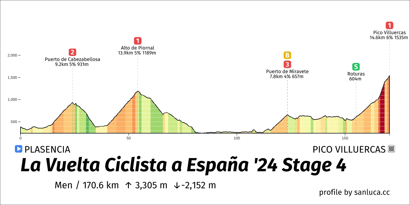
- Total distance: 170.6 km
- Type: Mountain
- Ascent: 3305.1 m
- Descent: -2151.9 m
- Date: Aug 20
- Start time: 11:27
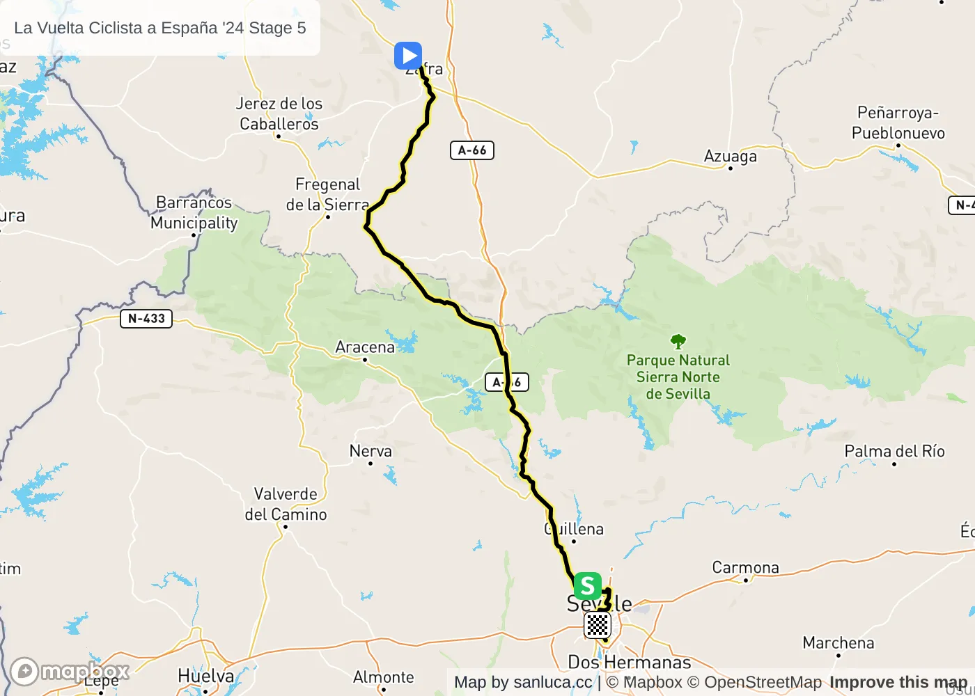
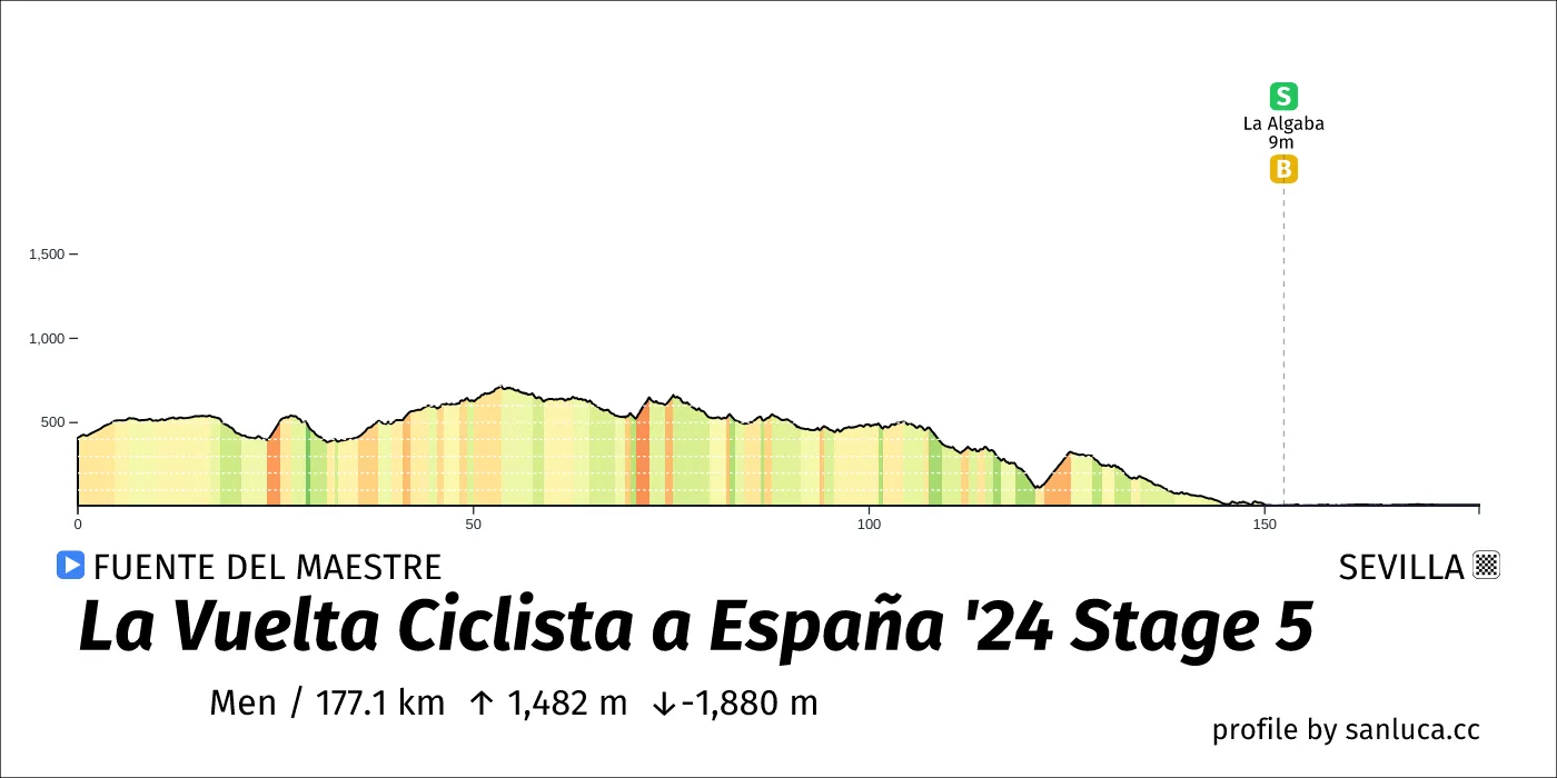
- Total distance: 177.1 km
- Type: Hilly
- Ascent: 1481.7 m
- Descent: -1880 m
- Date: Aug 21
- Start time: 11:34
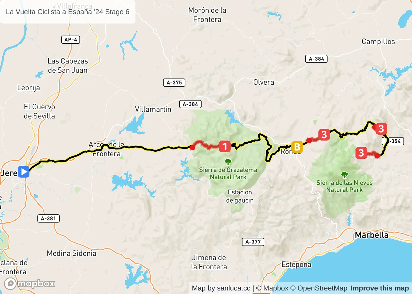
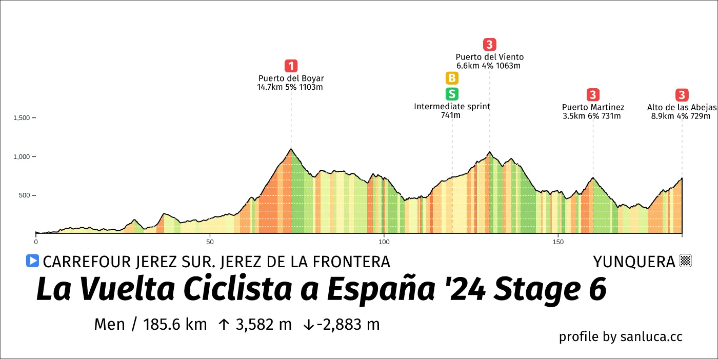
- Total distance: 185.6 km
- Type: Hilly
- Ascent: 3581.7 m
- Descent: -2883.4 m
- Date: Aug 22
- Start time: 10:59
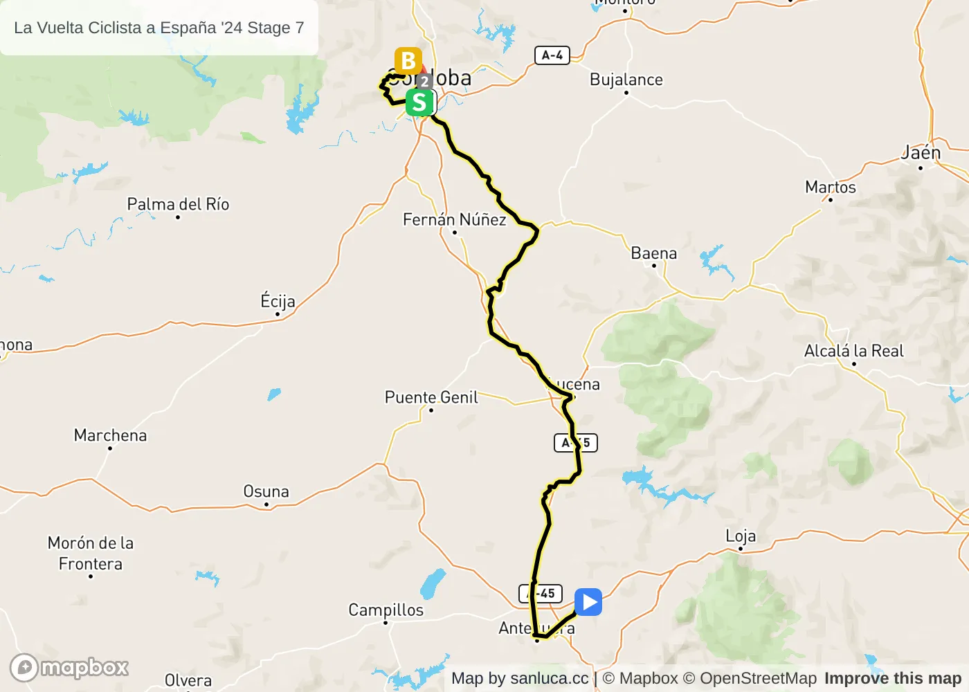
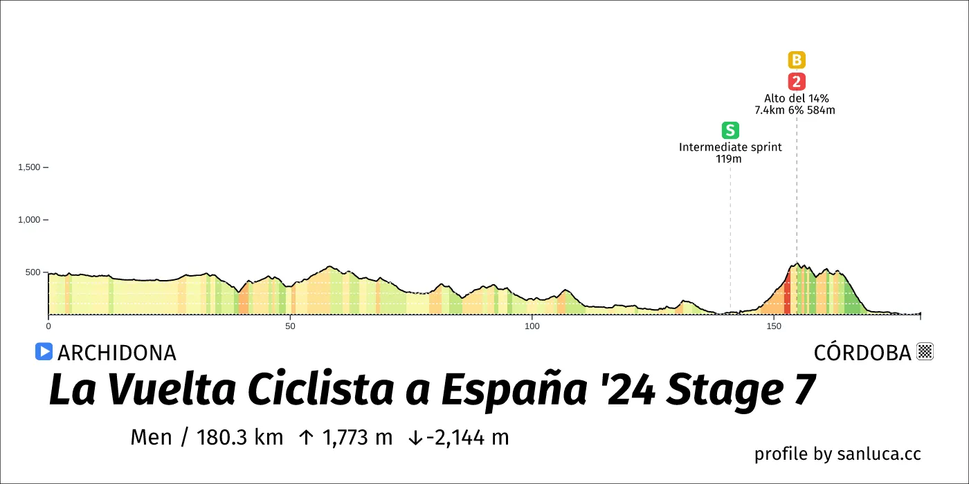
- Total distance: 180.3 km
- Type: Hilly
- Ascent: 1773.1 m
- Descent: -2144.2 m
- Date: Aug 23
- Start time: 11:25
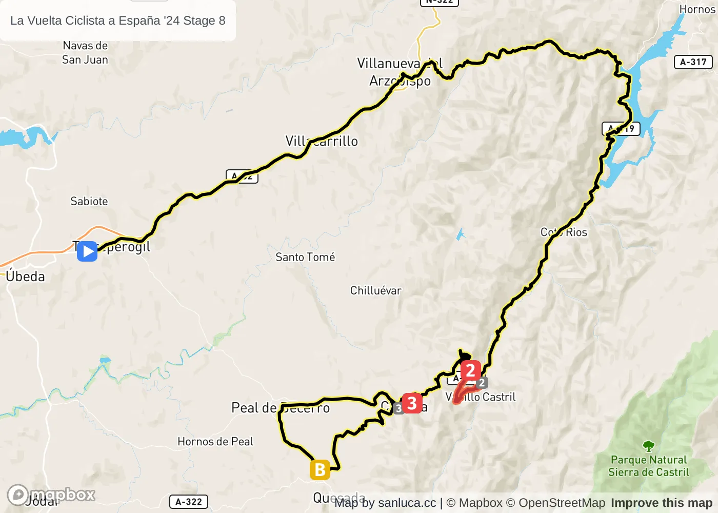
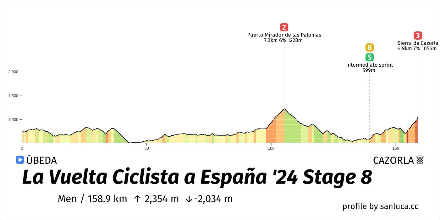
- Total distance: 158.9 km
- Type: Medium Mountain
- Ascent: 2354.3 m
- Descent: -2034.1 m
- Date: Aug 24
- Start time: 11:49
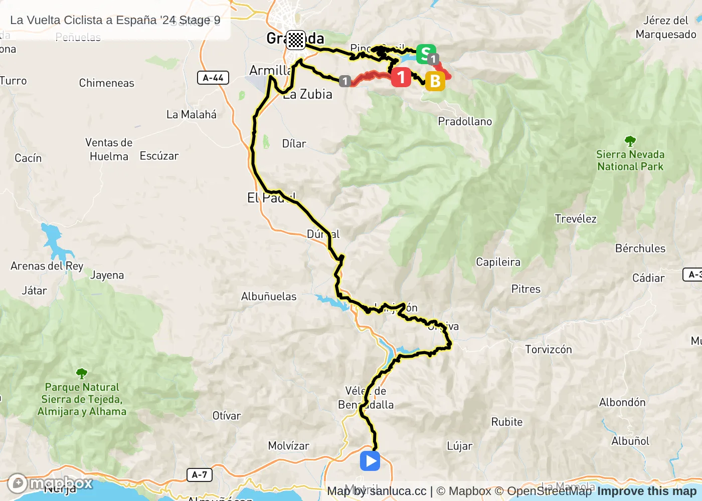
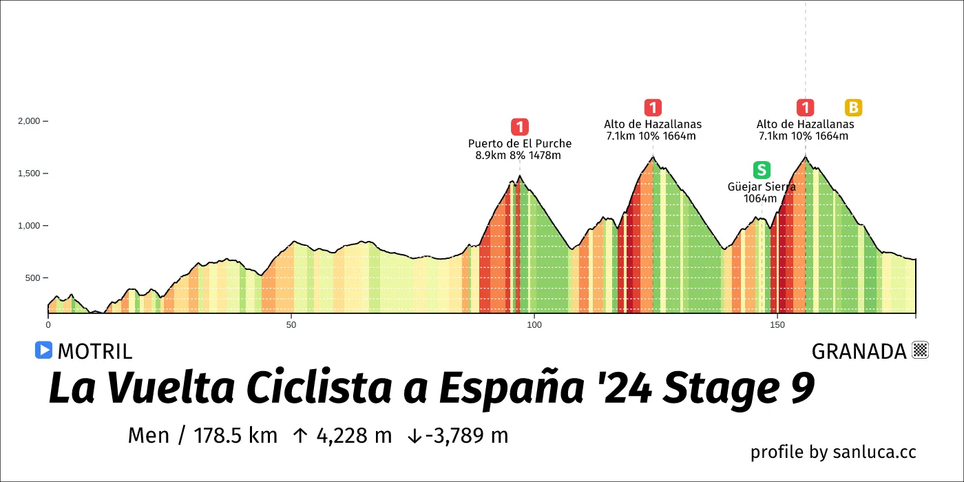
- Total distance: 178.5 km
- Type: Mountain
- Ascent: 4227.9 m
- Descent: -3789.1 m
- Date: Aug 25
- Start time: 10:49
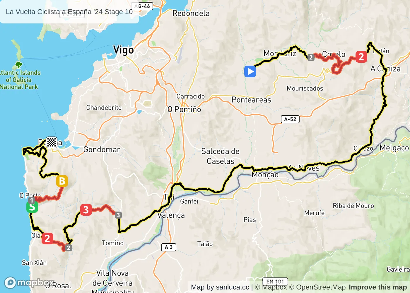
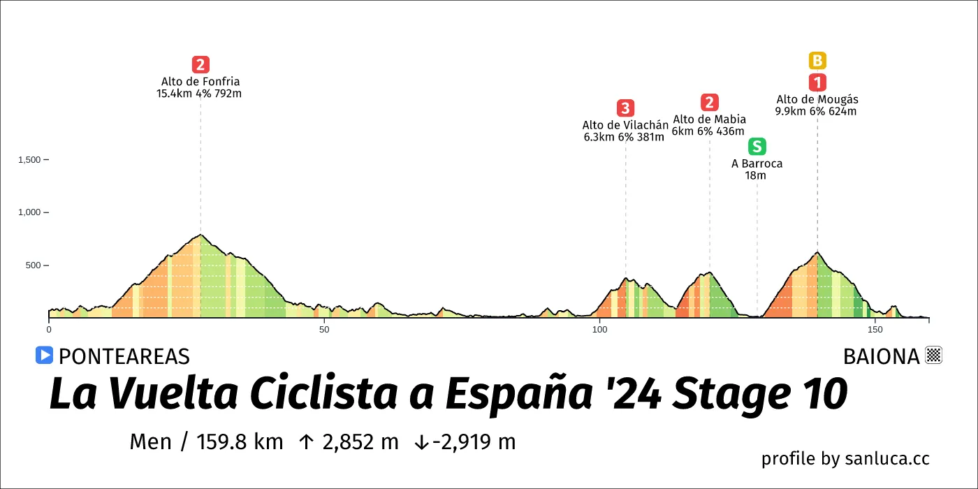
- Total distance: 159.8 km
- Type: Mountain
- Ascent: 2851.8 m
- Descent: -2919.3 m
- Date: Aug 27
- Start time: 11:42
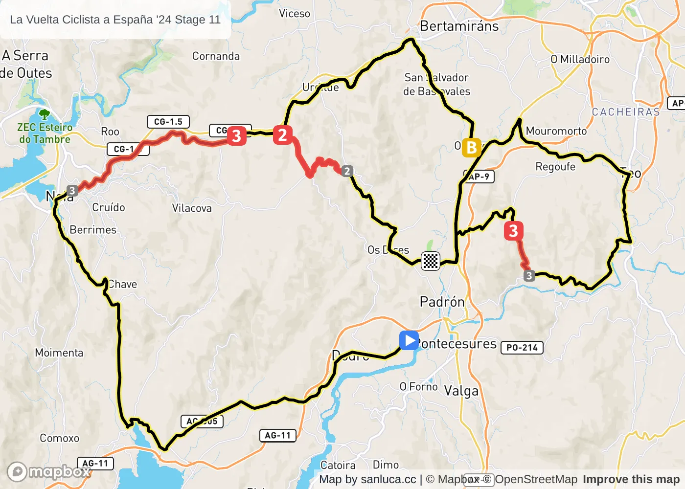
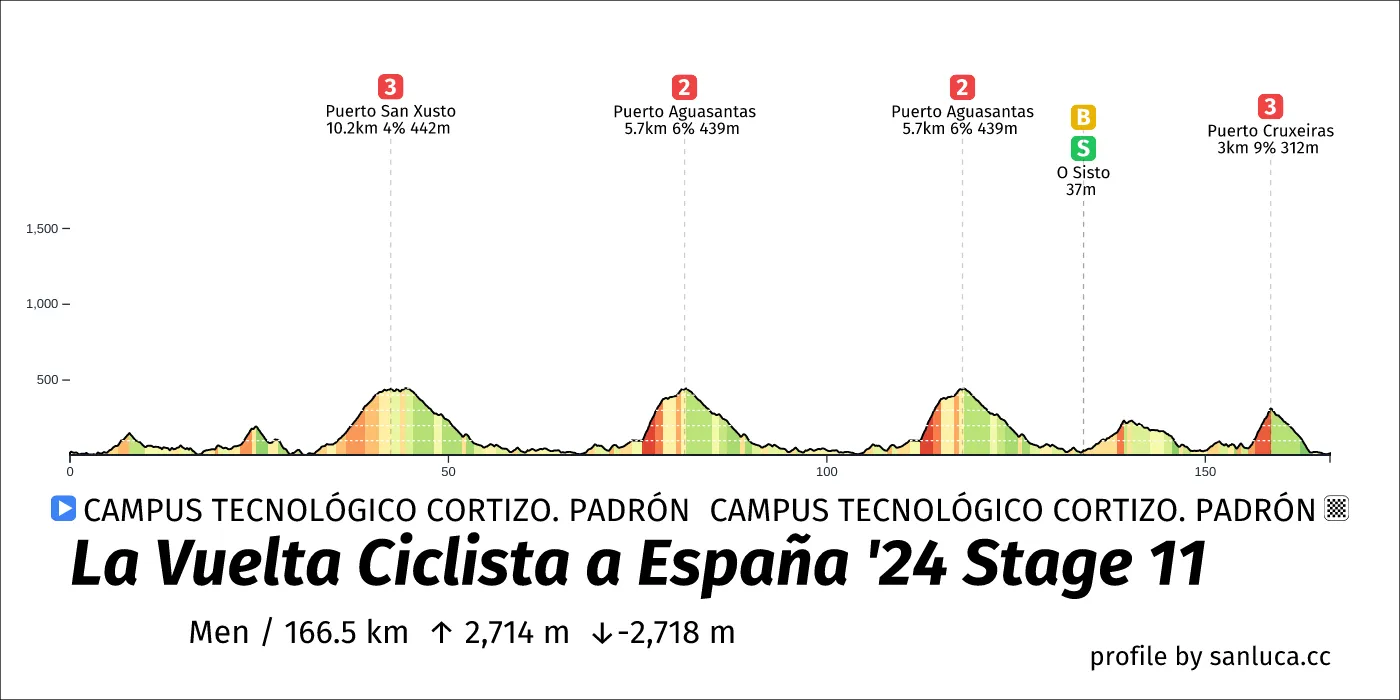
- Total distance: 166.5 km
- Type: Hilly
- Ascent: 2714.3 m
- Descent: -2718.4 m
- Date: Aug 28
- Start time: 11:44
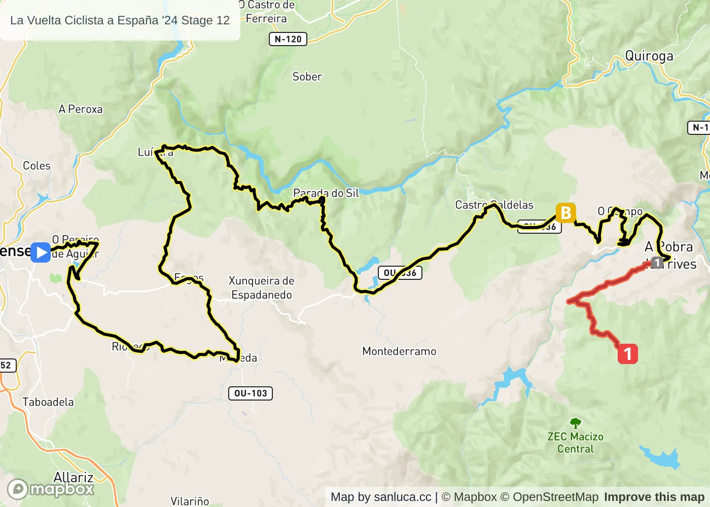
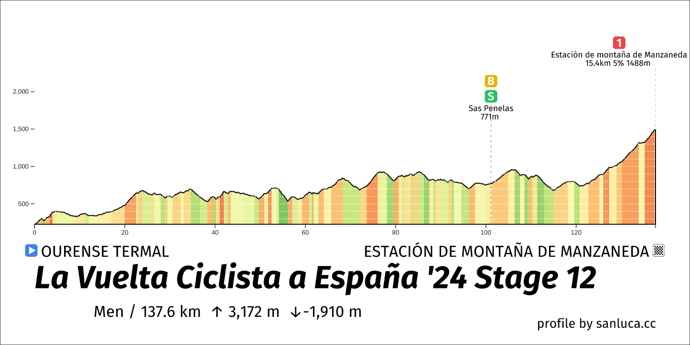
- Total distance: 137.6 km
- Type: Mountain
- Ascent: 3171.8 m
- Descent: -1910.4 m
- Date: Aug 29
- Start time: 12:19
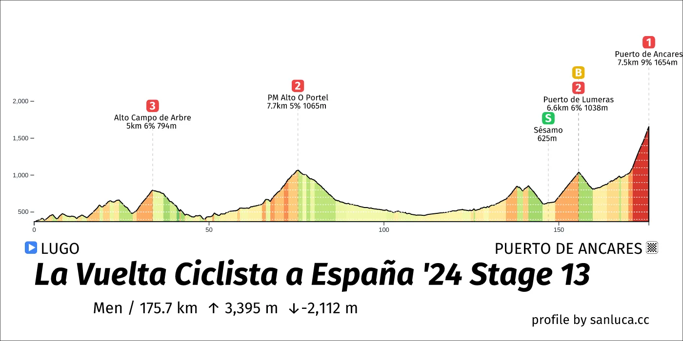
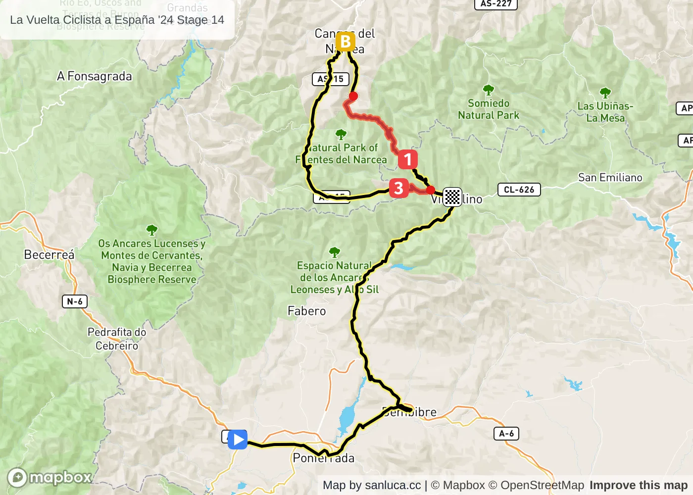
- Total distance: 175.7 km
- Type: Medium Mountain
- Ascent: 3395.4 m
- Descent: -2111.5 m
- Date: Aug 30
- Start time: 11:07
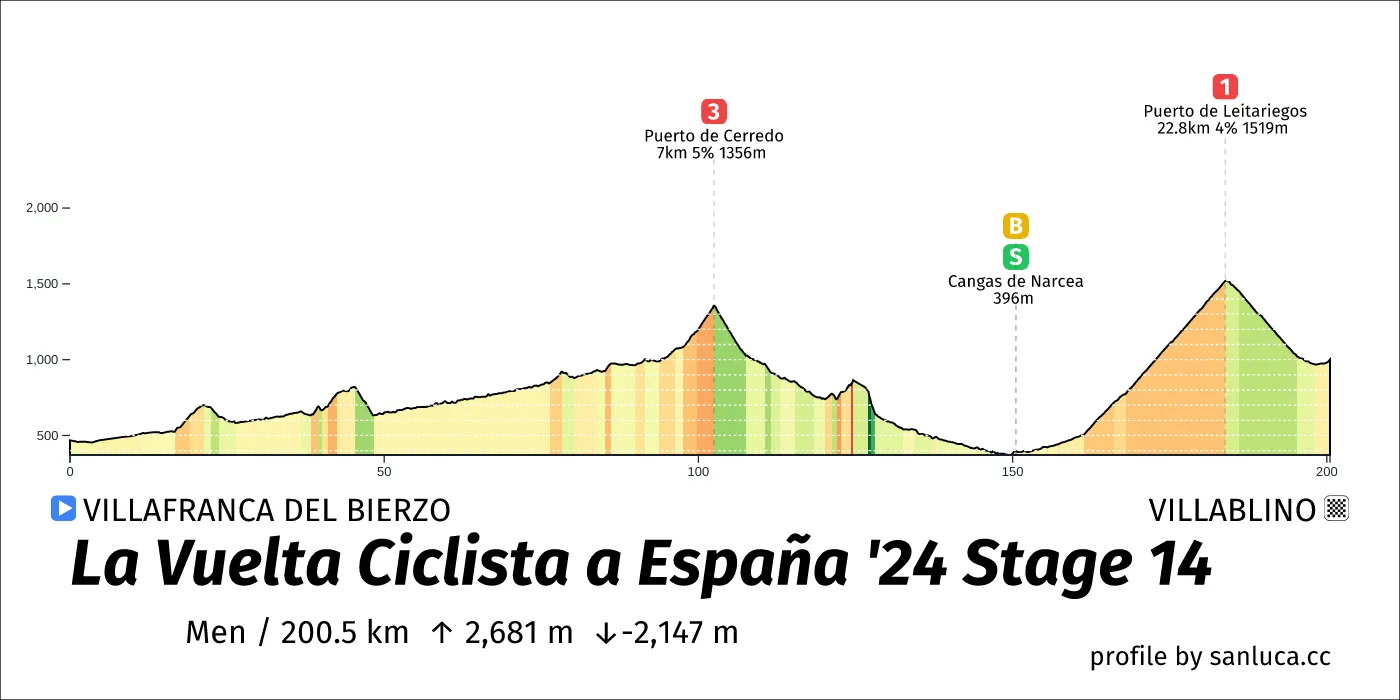
- Total distance: 200.5 km
- Type: Mountain
- Ascent: 2680.8 m
- Descent: -2147.4 m
- Date: Aug 31
- Start time: 10:37
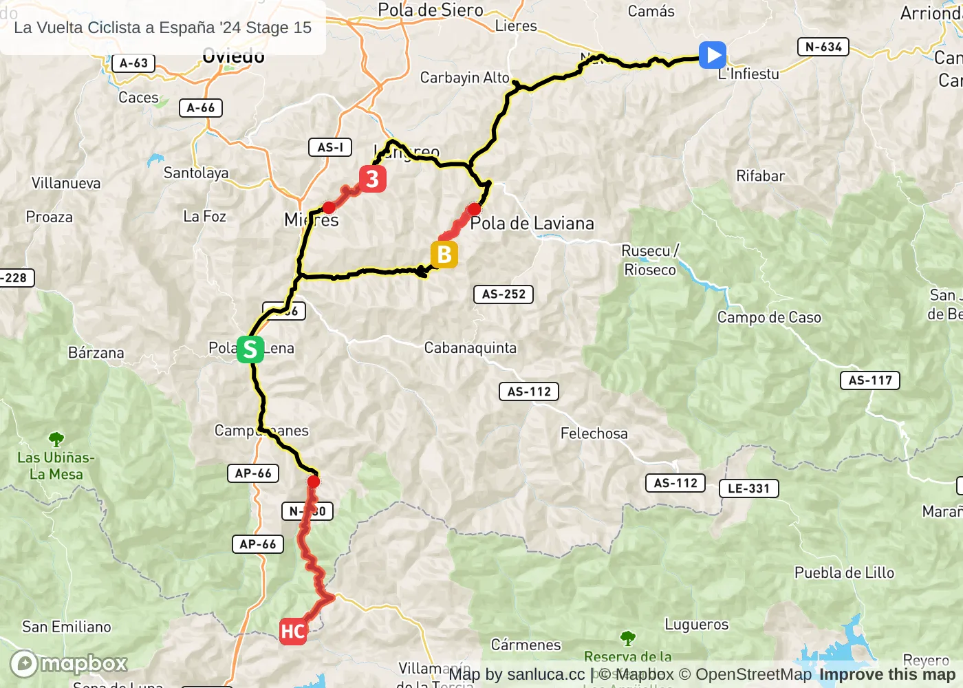
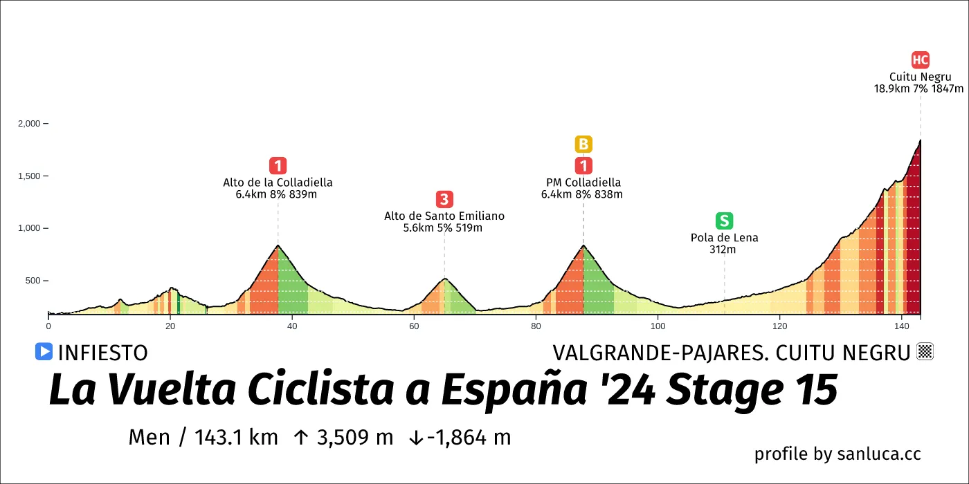
- Total distance: 143.1 km
- Type: Medium Mountain
- Ascent: 3508.9 m
- Descent: -1863.9 m
- Date: Sep 1
- Start time: 11:51
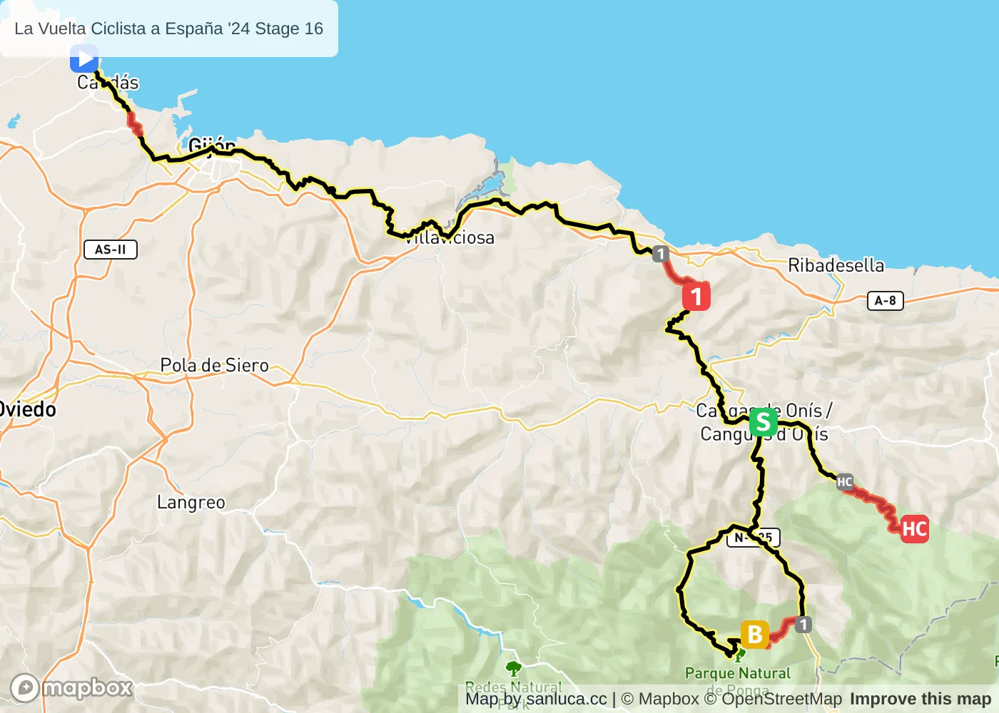
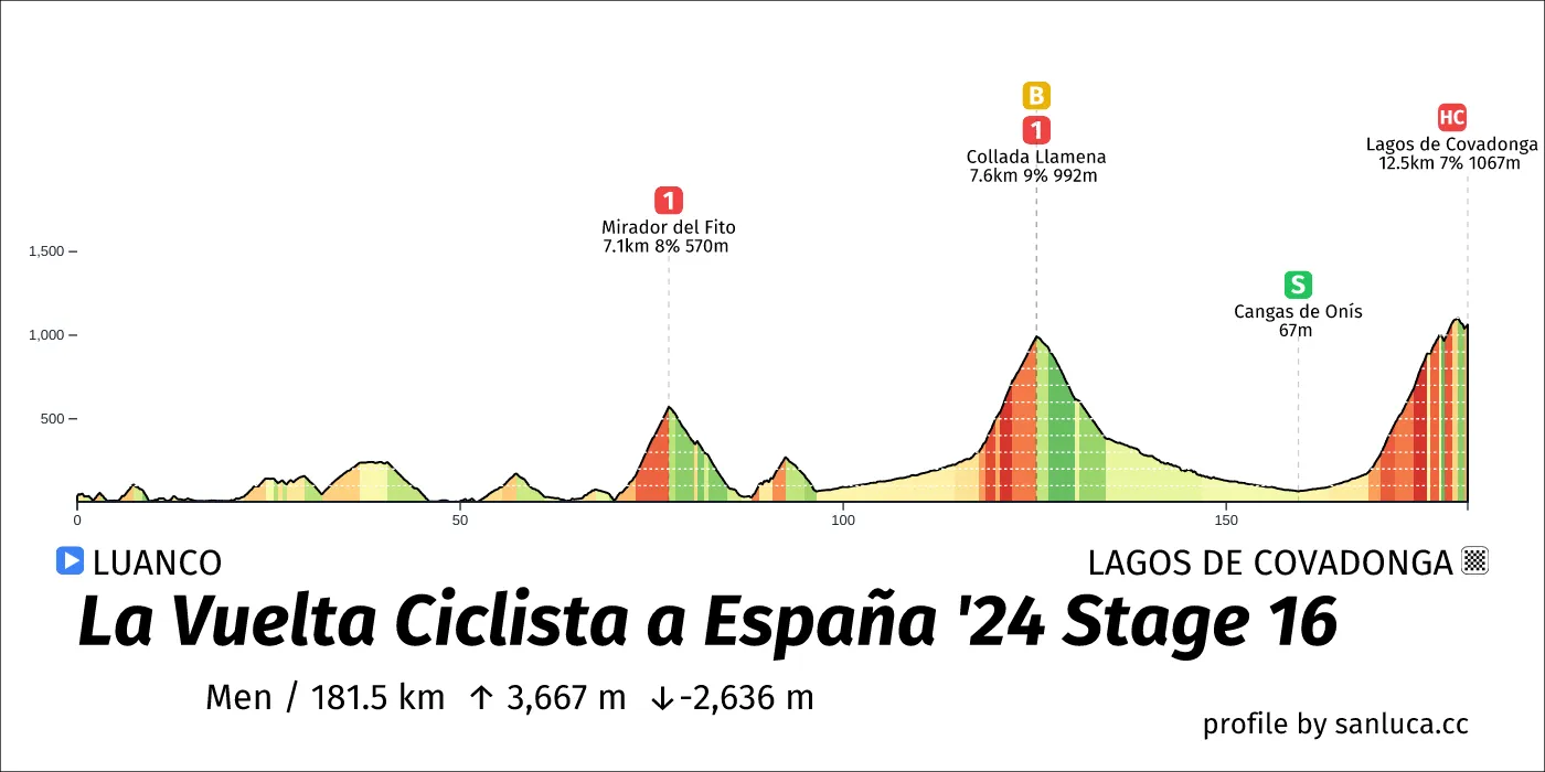
- Total distance: 181.5 km
- Type: Mountain
- Ascent: 3666.9 m
- Descent: -2635.9 m
- Date: Sep 3
- Start time: 10:59
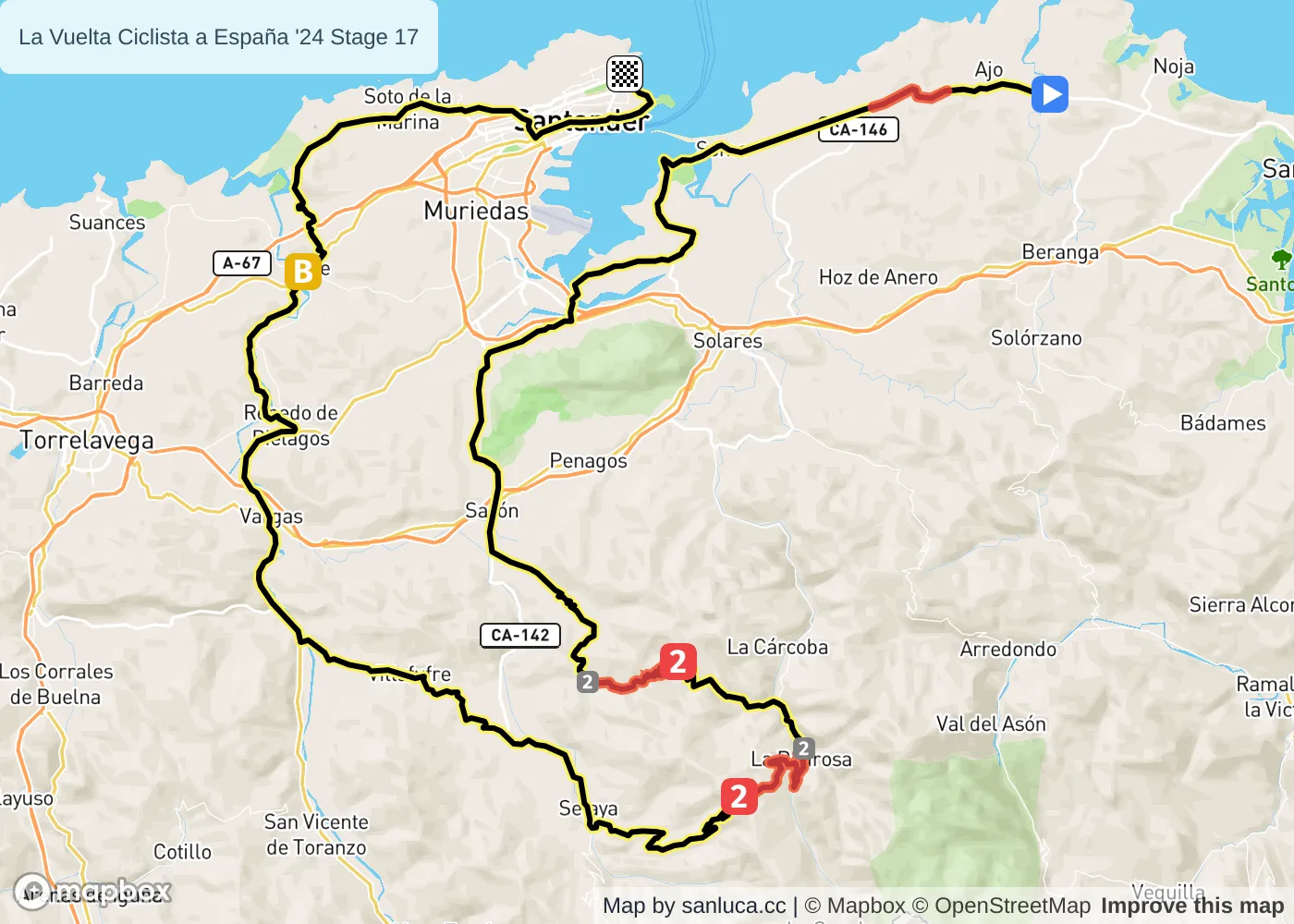
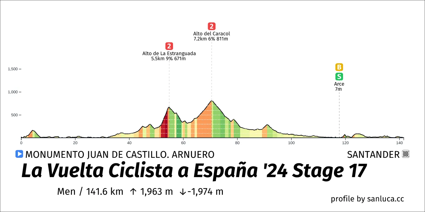
- Total distance: 141.6 km
- Type: Medium Mountain
- Ascent: 1962.9 m
- Descent: -1974 m
- Date: Sep 4
- Start time: 12:18
- Total distance: 179.5 km
- Type: Hilly
- Ascent: 2629.2 m
- Descent: -2505.3 m
- Date: Sep 5
- Start time: 11:20
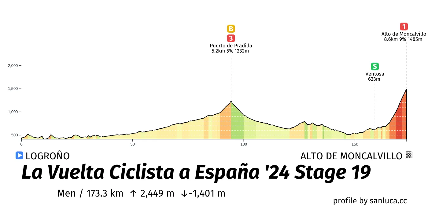
- Total distance: 173.3 km
- Type: Mountain
- Ascent: 2449 m
- Descent: -1401.1 m
- Date: Sep 6
- Start time: 11:29
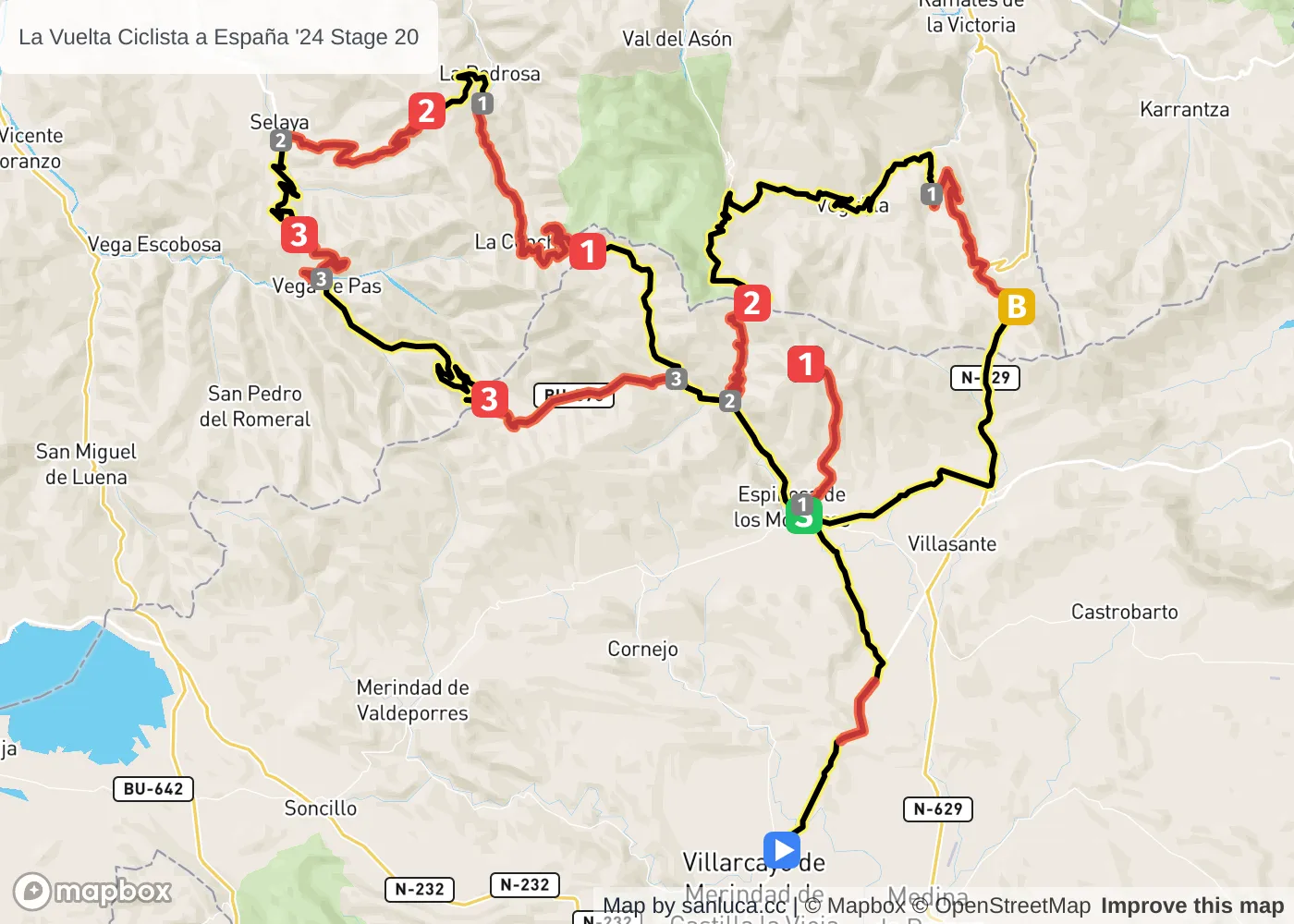
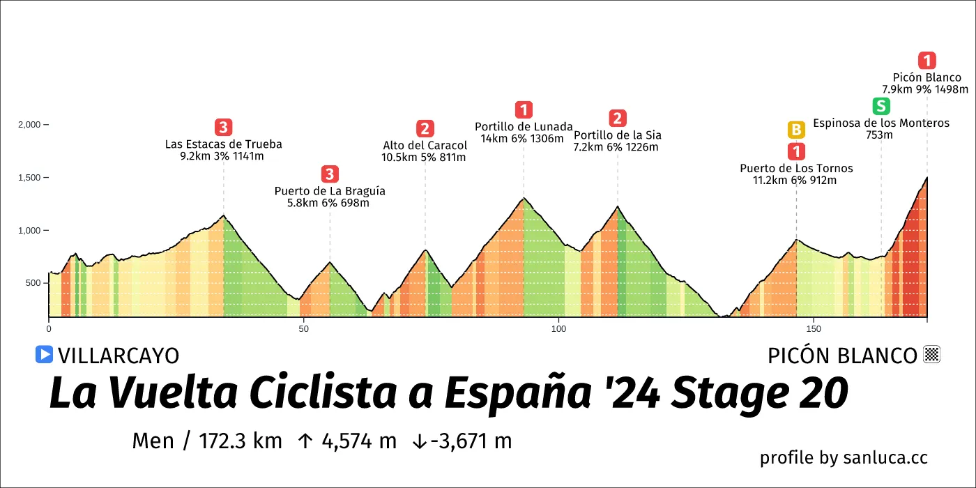
- Total distance: 172.3 km
- Type: Mountain
- Ascent: 4574.2 m
- Descent: -3671.1 m
- Date: Sep 7
- Start time: 11:06
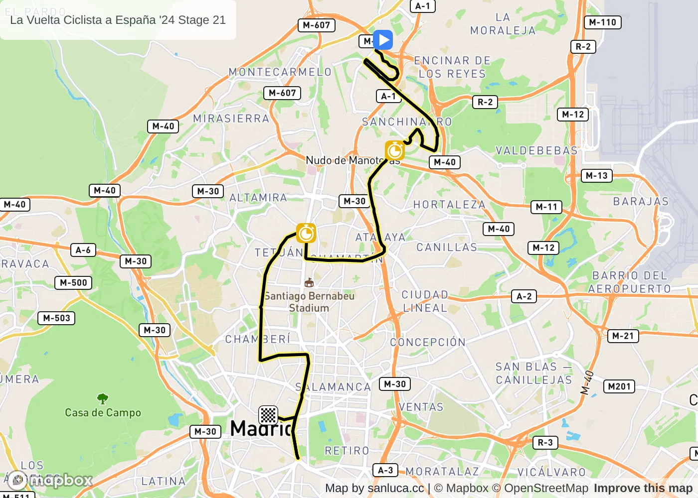
- Total distance: 24.5 km
- Type: Flat
- Ascent: 181.5 m
- Descent: -213.6 m
- Date: Sep 8
- Start time: 14:20
